Climbing the Seven Second Summits: Facts & Information
As the name suggests, the Seven Second Summits are the second-highest independent mountains on each of the seven continents.
While there is no exact date established for when the concept began to circulate, the idea of climbing the Seven Second Summits as a mountaineering challenge was first published in the January 1997 edition of Rock and Ice Magazine.
Keep reading: Climbing the Seven Volcanic Summits: Facts & Information
In January 2013, Austrian mountaineer Christian Strangl became the first confirmed person to successfully climb all eight potential candidates for the Seven Second Summits. However, there is some debate about whether Italian mountaineer Hans Kammerlander achieved the feat one year earlier.
To satisfy the broadest set of parameters, Strangl climbed Puncak Mandala in Indonesia and Mount Townsend in Australia, the second-highest summits in Oceania and Australia, respectively, according to the Reinhold Messner and Richard Bass lists for the Seven Summits.
Seven Second Summits At a Glance
| Peak | Elevation | Country | Continent |
|---|---|---|---|
| K2 | 8,611 m (28,251 ft) | Pakistan & China | Asia |
| Ojos del Salado | 6,893 m (22,615 ft) | Argentina & Chile | South America |
| Logan | 5,959 m (19,551 ft) | Canada | North America |
| Dykh-Tau | 5,205 m (17,077 ft) | Russia | Europe |
| Mount Kenya | 5,199 m (17,057 ft) | Kenya | Africa |
| Mount Tyree | 4,852 m (15,919 ft) | – | Antarctica |
| Puncak Mandala (Messner lst) | 4,760 m (15,617 ft) | Indonesia | Oceania |
| Mount Townshend (Bass list) | 2,209 m (7,247 ft) | Australia | Oceania |
Are the Seven Second Summits tougher than the Seven Summits?
While they may not be the highest points on their respective continents, completing the Seven Second Summits is considered a more formidable mountaineering challenge than the traditional Seven Summits.
Mountaineer and writer David Keaton suggested as much in his original article in Rock and Ice Magazine. Author and mountaineer Jon Krakauer reiterated this point in his book about the 1996 Everest disaster, Into Thin Air.
Indeed, there is little argument that climbing K2 is far more technically challenging and dangerous than climbing Mount Everest. In Africa, climbing to the highest summit of Mount Kenya is also much more technically challenging than the ascent of Kilimanjaro.
Most mountaineers also consider Dykh-Tau in Europe and Antarctica’s Mount Tyree more technically difficult and logistically complicated peaks to climb than either Elbrus or Mount Vinson.
Even Puncak Mandala and Mount Townsend are more difficult destinations than their slightly higher counterparts. While neither is considered more technically difficult than the Carstensz Pyramid (Puncak Jaya) or Mount Kosciuszko, both are more remotely located and, therefore, have longer ascents.
The only two peaks where there is some debate about which is the toughest comes in the Americas. Mountaineers continue to disagree on whether Denali or Mount Logan is the tougher climb. Most agree that Denali is more technical than the most accessible route up Logan, but some say factors such as its climate and remote location make Mount Logan more of a challenge.
Meanwhile, in South America, Ojos del Salado and Aconcagua both have similar profiles. Most agree that the scrambling on Ojos del Salado is more difficult than Aconcagua, but the ascent of Aconcagua is longer and more physically challenging.
1| K2
.jpg)
Casting an imposing shadow over the rest of the Karakoram Range stands the world’s most dangerous and formidable mountain: K2.
The world’s second-highest summit is also the toughest to climb and has long been known among the climbing community as the “savage mountain.” Situated on the border between Pakistan and China, K2 is located amid the highest concentration of 8,000-metre mountains on Earth.
While its prominent stature and dangerous reputation have made climbing K2 one of the most coveted challenges in mountaineering, fewer people have stood on its summit than been in space. On 16 January 2021, the peak became the last of the 8000ers to be climbed in the winter, a feat that is unlikely to be repeated anytime soon.
Despite the myriad difficulties associated with successfully making it to the top of K2, dozens of climbers attempt to reach the summit each year, adding to the mountain’s mystique.
Challenges of climbing K2
From the technical snow, rock and ice climbing required to reach its summit to the time spent in the so-called death zone and harsh weather conditions, there is no shortage of challenges associated with climbing K2.
Among the technical challenges are steep ascents up exposed ridgelines and rock faces, some of which have grades of up to 80 degrees. Due to the geography of the peak, avalanches are a constant threat throughout the ascent. The climb finishes with a steep ascent through the Bottleneck, a narrow couloir surrounded by unstable seracs to top it all off.
Away from the technical difficulty, the weather on K2 is incredibly harsh. Summertime temperatures routinely fall well below freezing. The top of the mountain also juts into the jet stream, which means it is almost constantly windy, with speeds reaching up to 200 kilometres per hour (124 miles per hour).
These high winds mean that very little snow is located at the top of the peak, so the final ascent of the summit requires climbing over brittle ice and exposed rock. This adds to the technical challenge of climbing K2.
The altitude presents yet another obstacle. Some of the most challenging climbing is done in the death zone, or the part of the mountain located above 8,000 metres (26,000 feet) where the body is deprived of oxygen. While in the death zone, climbers may suffer from the failure of vital functions and have trouble with motor skills and making decisions.
How To Get To K2
The vast majority of trips to K2 begin with a flight to Islamabad International Airport (ISB). From here, most guides will meet with participants and transfer to Skardu. From Skardu, it takes about 10 days of driving and trekking to get to base camp.
It is also possible to climb K2 from the north side. Expeditions from the Chinese side of the border usually begin with a flight to Kashgar Airport (KHG), which can be reached from any of China's main international airports. Most guides opt to meet in Kashgar and provide transport to the start of the expedition.
Routes to the summit of K2
About 10 different routes lead up to the summit of K2, but only one is commonly used: the Abruzzi Spur. The Abruzzi Spur was the first route to be successfully climbed and is used by about 75 percent of the climbers who attempt to reach the summit.
The route follows the mountain’s southeast ridge, ascending from about 5,400 metres (17,700 feet) to the top at 8,611 metres (28,251 feet). Along the way, climbers will traverse rocky ribs, snow and ice fields, and two highly technical rock climbing portions – the House’s Chimney and Black Pyramid.
The climb’s final portion is the Bottleneck, a deep and narrow couloir surrounded by unstable seracs. After passing through the feature, climbers reach the top.
Away from the Abruzzi Spur, the Cesen Route (also known as the South-Southeast Spur) is the second most popular way to the top. It takes a bit longer but is slightly less technically challenging, climbing a pillar adjacent to the Abruzzi Spur before meeting that route above the Black Pyramid.
Other routes to the top are far more rarely climbed and generally more difficult and dangerous, including the north ridge, the northeast ridge, the west ridge, the southwest pillar, the south face, the northwest face, the northwest ridge and the west face.
Quick facts:
- Continent: Asia
- Location: Pakistan/China
- Elevation: 8,611 m (28,251 ft)
- Duration: 8 to 9 weeks
- Climbing season: June to September
2| Ojos del Salado
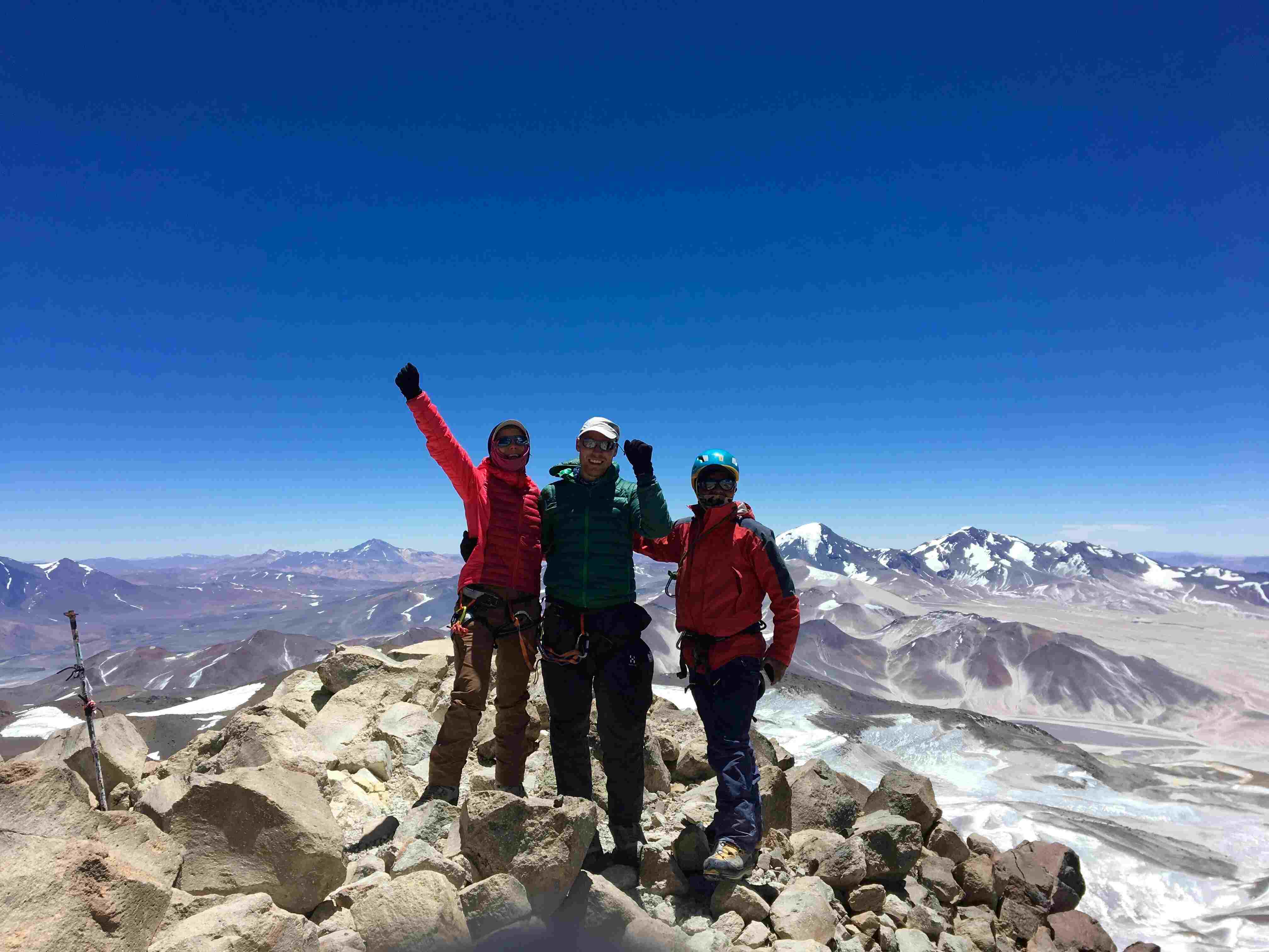
Towering above the Atacama Desert on the western slopes of the Andes Mountains, Ojos del Salado straddles the border between Chile and Argentina.
The massive igneous peak is the tallest mountain in Chile and the highest volcanic summit in South America. Rising to nearly 6,900 metres (22.640 feet) in elevation, the active stratovolcano is also the second-highest mountain outside of Asia and is only 67 metres (220 feet) shorter than nearby Aconcagua.
Ojos del Salado is composed of two separate summits, with one on each side of the border. The Chilean side is technically a few metres higher, but there is no visible difference between them. The mountain is frequently climbed from both sides of the border.
Due to its notoriety, relative ease of access and favourable climate, Ojos del Salado is one of South America’s most popular mountaineering destinations.
Challenges of climbing Ojos del Salado
While Ojos del Salado is considered a trekking peak and requires no technical difficulty to climb, there are still several challenges that mountaineers will face en route to the top.
Adjusting to the high altitude and dealing with the diverse climates are the two main challenges that mountaineers will face.
Ojos del Salado rises to 6,893 metres (22,615 feet) above sea level and boasts 3,688-metres (12,100-feet) of prominence. As a result, altitude sickness is one of the main challenges climbers face.
To make it safely up and down the volcanic peak, it is essential to be in excellent physical condition and spend enough time acclimating on the slopes of the peak or other nearby mountains.
Away from the elevation, Ojos del Salado also presents some climatic challenges to climbers. The temperature differential between the base and summit is enormous, meaning packing plenty of layers is key to a successful ascent. High winds on the exposed slopes and ridges at the top of the peak also make the climb more challenging.
How to get to Ojos del Salado
For climbers heading up Ojos del Salado from the Argentine side of the border, it is best to fly into Capitán Vicente Almandos Almonacid Airport (IRJ) in La Rioja or Coronel Felipe Varela International Airport (CTC) in Catamarca.
Some guides may opt to meet in one of these cities. Otherwise, it is also possible to transfer by bus to Fiambalá, a popular starting point for the climb.
From the Chilean side, it is easiest to fly into Desierto de Atacama Airport (CPO) in Copiapó. Most guides will opt to meet here and provide transport to the start of the trip.
Routes to the summit of Ojos del Salado
Three main routes lead up to the two summits of Ojos del Salado, two of which begin from the Argentine side of the border and one that begins from the Chilean side.
The route starting from the Chilean side is the easiest and most popular. Part of the reason for this is the climb begins from a much higher altitude and offers more amenities along the way.
The ascent via this route starts after driving to the Refugio Atacama at 5,200 metres (17,000 feet). From here, climbers hike up the side of the mountain, cutting diagonally across one of its slopes toward the summit.
The only challenging part is the final section, which requires some previous scrambling experience over the loose volcanic scree. While the scrambling itself is not hard, the wind and altitude make it more challenging.
The Ruta Varsoviana is the most popularly taken on the Argentine side and is known as the normal route. Starting from El Arenal, climbers ascend steeply up the mountain’s southern side before reaching the saddle. Some sections of this ascent require scrambling.
From the saddle, climbers continue scrambling along the steep ridgeline, past the base of the summit pyramid and onto the top.
The Mike Dorse Direct route is the third one that leads to the top of Ojos del Salado and is also the toughest. The route also begins from El Arenal before veering off to the left. Climbers will make their way to the foot of the mountain’s glacier before making a steep ice climbing ascent.
Once at the top of the glacier, climbers follow the same ridgeline as the Ruta Varsoviana to the summit.
Quick facts:
- Continent: South America
- Location: Argentina/Chile
- Elevation: 6,893 m (22,615 ft)
- Duration: 2 weeks
- Climbing season: December to March
3| Mount Logan
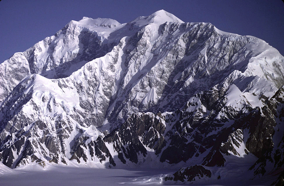
Rising high above its surroundings, at the heart of Kluane National Park, the Mount Logan massif casts an imposing shadow over its surroundings and is one of North America’s premier mountaineering destinations.
Composed of 11 separate summits, each of which reaches a minimum of 5,000 metres (16,400 feet) in elevation, the Logan massif cuts an impressive silhouette on the horizon. Along with being immensely tall, the massif is enormous, measuring 20 kilometres (12.5 miles) long by 5 kilometres (3 miles) wide.
Logan is not only the tallest mountain in Canada but also the largest by base circumference of any non-volcanic peak in the world. In short, the mountain is a behemoth.
Due, in part, to its incredibly remote location and diverse climbing opportunities, the Logan massif has become a veritable playground for experienced mountaineers and ski tourers looking for an adventure holiday away from the crowds.
The western slopes of the peak are frequented by ski mountaineers, who skin their way to the top before careening back down the peak’s pristine glaciers. Meanwhile, the eastern wall of the main summit is considered the best alpine wall climb spot in all of North America.
Challenges of climbing Mount Logan
While the most accessible routes up to the summit of Mount Logan require no technical difficulty to climb, the peak presents plenty of other challenges.
Due to its remote location, climbers will need to haul all of the gear to base camp and the various high camps on the mountain’s slopes. The mountain is also quite prominent and steep, so a high level of physical fitness and proper acclimatisation is required.
Mountaineers headed to the East Ridge Route will also need advanced ice climbing abilities as the eastern wall is one of the toughest on the continent.
Once on the mountain, the weather can change quickly, and the massif frequently experiences worse weather than either nearby Mt Saint-Elias or Denali.
Thunderstorms and even blizzards can quickly enshroud the mountain during the climbing season. Temperatures at higher elevations are frequently as low as −27 °C (−17 °F) at higher elevations. The higher elevations are also exposed to significant wind, which lowers visibility, makes climbing harder and lowers the perceived temperature.
How to get to Mount Logan
Due to its remote nature, Mount Logan is quite tricky to get to. Getting here begins with a flight to Haines Junction Airport (YHT), which can be reached by a charter flight from Erik Nielsen Whitehorse International Airport (YXY). From here, you will meet your guide and take another flight to get to Kluane National Park.
Routes to the summit of Mount Logan
The Kings Trench Route and the East Ridge Route are the two main routes that lead up to the summit of Mount Logan.
The Kings Trench Route heads up to Logan’s main summit from the western side of the massif and is considered the easiest of the two routes. Ascents via this route generally begin with a flight into the Quintino Sella Glacier.
From here, the ascent is pretty straightforward, with a long but steady climb up the mountain’s glacier system. Many mountaineers opt to climb and descend the mountain with skis. The ascent is simple enough to be done in skins, and the skiing descent is one of the most scenic and exciting in Canada.
On the other side of the massif, the East Ridge Route is far more grueling and technically challenging but quite popular for advanced climbers. The route involves an ascent of perhaps the best alpine wall in all of North America, which rises 4,000 vertical metres (13,1000 feet).
After ascending the wall, climbers will arrive at the mountain’s east ridge and follow it to the summit.
Away from these two routes, four others are sometimes used: Warbler Ridge, West Ridge, South-Southwest Ridge and the North Ridge. However, none of these are used commercially.
Quick facts:
- Continent: North America
- Location: Canada
- Elevation: 5,959 m (19,551 ft)
- Duration: 3 weeks
- Climbing season: June to August
4| Dykh-Tau
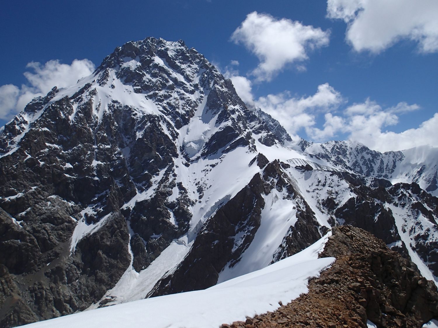
Situated in the heart of the Caucasus Range, Dykh-Tau is the second-highest mountain in Russia and all of Europe.
Rising to 5,205 metres (17,077 feet) in elevation, the peak sits at the northern edge of the Bezengi massif and offers some of the best, most technical climbing in the region.
Well-known for its imposing north face, Dykh-Tau is not as frequently climbed as its neighbours, Bezengi-Koshtan and Shchara. The climb to its summit is incredibly challenging due to the danger posed by avalanches and no straightforward route to the summit.
Despite this, Dykh-Tau is frequently climbed in combination with Mount Elbrus. Located just 65 kilometres (40 miles) southeast of the continent’s highest summit, the peak is sometimes climbed before as an acclimatisation exercise.
Challenges of climbing Dykh-Tau
Climbing Dykh-Tau presents many different challenges, ranging from technical difficulty to climate and altitude.
Even the easiest route to the summit – the North Ridge Route – is rated as a Russian 4B (UIAA Class IV/V) and requires steep rock, glacier and ice climbing to reach the summit. Adding to the difficulty, much of the climbing is done along exposed ridgelines constantly at risk of avalanche.
During the summer climbing season, temperatures on Dykh-Tau frequently drop below freezing and feel even colder with the windchill. The mountain’s north face is also highly exposed, meaning there is little respite from the wind.
Along with the climate and technical difficulties, climbing the mountain also poses a physical challenge. About 3,000 metres (9,800 feet) separate Dykh-Tau’s base camp from its summit, so taking the time to acclimate properly is very important. Much of the climbing is also very steep, so climbers need to be incredibly fit.
How to get to Dykh-Tau
Any trip to Dykh-Tau begins with a flight to Mineralnye Vody Airport (MRV), which can be reached via a connection from any of Russia’s main airports or several of the larger regional airports. Guides will almost exclusively opt to meet guides here and provide transport to the start of the trip.
Routes to the summit of Dykh-Tau
The North Ridge Route is the main route used to climb Dykh-Tau. Starting from the base camp at 2,200 metres (7,200 feet), climbers ascend the glacier, avoiding its various crevasses until they arrive at the icefall beneath the saddle.
Once at the icefall, climbers will need to make the 12 to 15-pitch ascent, which varies in steepness from 30 to 40 degrees, until arriving at the saddle between the south ridge of Misses Tau and the north ridge.
Once on the saddle, climbers will head north, making the eight to 10-pitch ascent of the saddle until arriving at a rocky part where it is possible to camp. The following day, climbers will continue to follow the ridge, which gets less steep, arriving at the crux. There is one last steep and technical ridge from the crux to climb up the north face before reaching the summit.
Quick facts:
- Continent: Europe
- Location: Russia
- Elevation: 5,205 m (17,077 ft)
- Duration: 10 to 12 days
- Climbing season: June to September
5| Mount Kenya
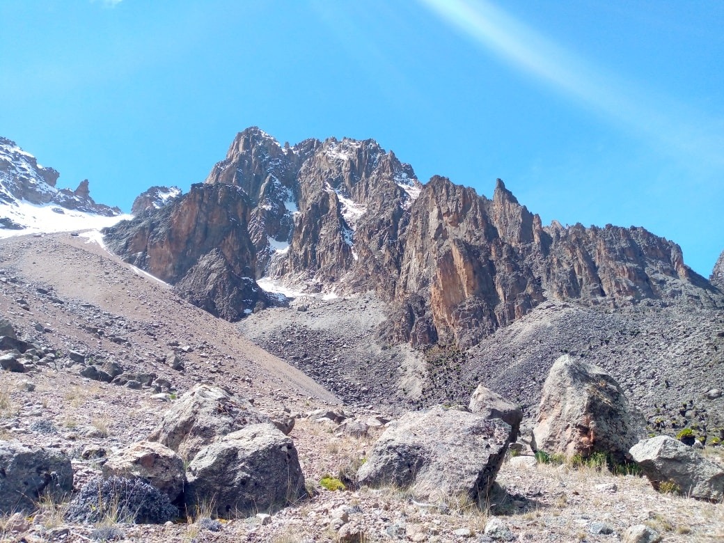
Situated in the heart of the Eastern Rift Mountains, roughly 150 kilometres (90 miles) north-northwest of the Kenyan capital of Nairobi, stands the imposing igneous slopes of Mount Kenya.
Kenya’s highest peak and Africa’s second-highest mountain after Kilimanjaro boasts various mountaineering options and offers perfect routes for climbers of every ability level.
The dormant stratovolcano is composed of three separate summits – Batian (5,199 m/17,057 ft), Nelion (5,188 m/17,021 ft) and Point Lenana (4,985 m/16,355 ft). Each of these summits requires differing levels of technical ability to reach.
However, most climbers often opt to trek through the surrounding national park, enjoying the various microclimates and endemic plants and wildlife before climbing the shortest of the summits. More adventurous mountaineers generally climb all three summits.
Challenges of climbing Mount Kenya
Each of Mount Kenya’s three summits requires a differing level of technical ability and physical fitness to climb successfully.
The shortest summit – Point Lenana – is a trekking peak and only requires intermediate-level trekking abilities and a good level of physical fitness to reach.
Nelion, the second-highest summit, on the other hand, requires slightly more technical rock climbing abilities. Climbers heading to this summit must be prepared for a sustained multi-pitch ascent ranging in difficulty up to Class IV-.
Keep reading: Top 5 Climbing Destinations in East Africa
Along with being the highest peak, Batian is also the toughest. The ascent to Batian, which can be made in addition to the ascent of Nelion, requires an even steeper multi-pitch ascent ranging in difficulty from Class IV to IV+.
Regardless of the chosen route, climbers will also need to be appropriately acclimated as the mountain is quite prominent – 3,825 metres (12,549 feet) separate the base from the summit. Mount Kenya also poses several climatic challenges, including temperatures that frequently dip to below freezing at higher elevations and high winds along the peak’s exposed slopes.
How to get to Mount Kenya
Most trips to Mount Kenya begin with a flight to Jomo Kenyatta International Airport (NBO) in Nairobi. Nearly all guides will opt to meet here and provide transport to the start of the trip. Traveling in Kenya can be dangerous (car-jackings around the airport are not uncommon), so it is highly inadvisable to rent a car and drive.
Routes to the summit of Mount Kenya
Five main routes lead to the Point Lenana summit, and an additional five routes are used to climb Nelion and Batian.
Due to the many routes up to the top of Point Lenana, most climbers opt to take one route up and a different one down. The most popular routes are the Naro Moru route and Sirimon route.
The Naro Moru route is the shortest and approaches Point Lenana from the west. Meanwhile, the Sirimon route is slightly longer and climbs the peak from the north.
For climbers continuing to Nelion and Batian, the south ridge route and north face route, respectively, are the two most popular.
The south ridge route to Nelion is considered to be the most scenic up the mountain but boasts plenty of challenges. Climbers will make an 18-pitch ascent up to the summit, with the climbing rated as high as Class IV-.
The north face route that leads up to Batian is also quite scenic, which is why it is the most popular, but also very challenging. Climbers should expect to spend about 12 hours making the multi-pitch ascent. The climb generally takes two days, with many opting to set up camp on one of the narrow shelves that cut into the rock face.
Away from these routes, two great combined routes allow climbers to reach both Nelion and Batian: the Ice Window route (Class V-) and the Diamond Couloir (Class VI).
Quick facts:
- Continent: Africa
- Location: Kenya
- Elevation: 5,199 m (17,057 ft)
- Duration: 1 week
- Climbing season: December to March, July to September
6| Mount Tyree
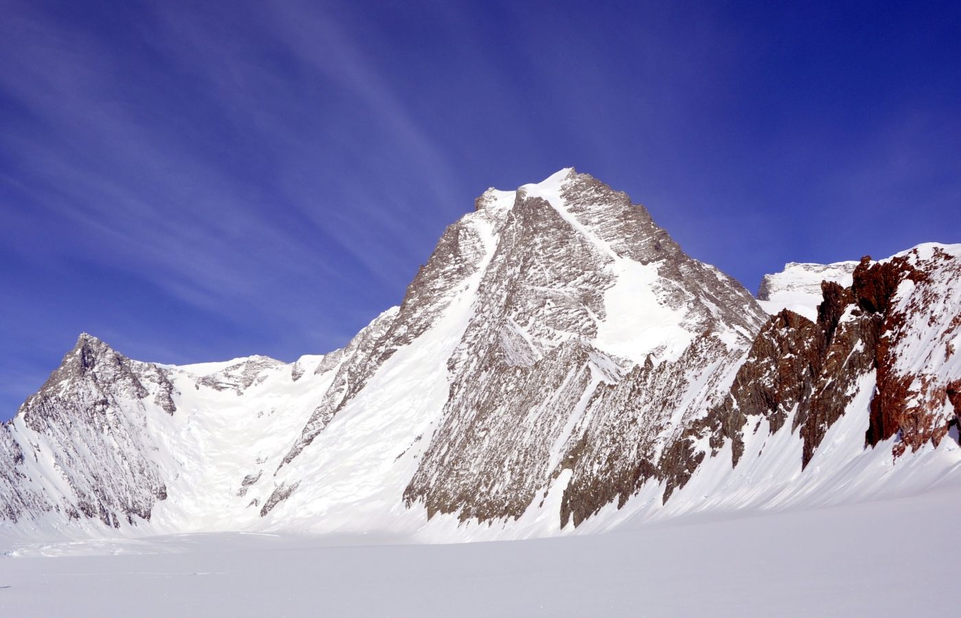
Located in the heart of the Sentinel Range in western Antarctica, the continent’s second-highest peak rises 4,852 metres (15,919 feet) above sea level.
Sitting just 13 kilometres (8 miles) northwest of the Vinson massif, the continent's highest peak, Mount Tyree is about 40 metres (130 feet) shorter but considered to be far more technically, physically and mentally challenging.
Fewer than two dozen people have successfully made it to the mountain’s summit, which requires highly technical rock and ice climbing over extended periods in a highly exposed environment.
Despite the difficulty, the climbers who have successfully made the trip describe it as one of the most scenic on the continent, with spectacular views over the Sentinel Range and toward continental West Antarctica.
Challenges of climbing Mount Tyree
Climbing Mount Tyree provides a range of challenges for even the most advanced climbers, from the harsh winter conditions on the mountain to its remote location and technically challenging slopes.
The most commonly used route to the summit requires a steep glacier climbing ascent of the main couloir before arriving on the northeast ridge and making a long, steep and technical rock and ice climbing ascent up to the summit.
The climbing is done in the harsh continental Antarctic climate, with daily highs during the climbing season reaching just −30 °C (−20 °F) near the summit. The peak is also highly exposed to wind and the elements. While the weather tends to be milder in the summer, storms can envelop the peak quickly at any time of year.
Away from the weather and technical challenges, the peak is also incredibly isolated. It is located about 200 kilometres (125 miles) away from the Union Glacier Camp. This means climbers need to haul all of their gear and must be self-sufficient for the duration of the ascent.
How to get to Mount Tyree
All expeditions to Mount Tyree begin with a flight to the international airport in Punta Arenas (PUQ), Chile. Most guides will opt to meet up in the city and charter a flight to Union Glacier in Antarctica. From here, climbers will transfer to the base camp at the foot of the mountain.
Routes to the summit of Mount Tyree
While three routes have been taken to the summit of Mount Tyree, the French route is the most commonly used.
After flying onto Patton Glacier, just northeast of the mountain, climbers will ski to the base of the peak and set up the base camp. From base camp, climbers will ascend through the grand couloir before arriving on the northeast ridge, where most climbers opt to set up a high camp.
Climbers will follow the northeast ridge to the summit from the high camp, which requires a long day of technical mixed rock and ice climbing.
The south face of the mountain, which is home to one of Antarctica’s largest walls at 2,000 metres (6,600 feet), remains unclimbed.
Quick facts:
- Continent: Antarctica
- Elevation: 4,852 m (15,919 ft)
- Duration: 3 weeks
- Climbing season: December to January
7a| Puncak Mandala
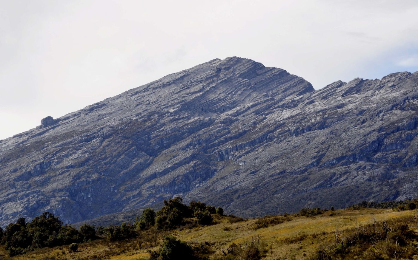
Towering above the equatorial rainforest that enshrouds its slopes, Puncak Mandala – also known as Mandala Peak – is the shortest of the Seven Second Summits on the Messner list.
Located amid the Jayawijaya Range, in the heart of the island of New Guinea, Puncak Mandala is the second-highest peak in Indonesia and in Oceania, just behind nearby Puncak Jaya (also known as the Carstensz Pyramid).
The mountain has long been a popular cultural tourism destination, with the trek to the peak’s base camp providing unparalleled views of the ancient rainforest and the chance to meet some of the local tribes who live in the area.
Two separate routes lead to the summit from the northern and southern sides of the mountain. However, one route is far more accessible than the other, which is one of the most technically challenging routes on the Seven Second Summits.
Challenges of climbing Puncak Mandala
The easiest route to the summit of Puncak Mandala requires no technical abilities. Fit trekkers can simply walk and scramble up the north face of the mountain to its summit.
Despite the lack of technical difficulty, there still are several challenges associated with climbing the peak. Puncak Mandala is remotely located, so climbers will need to haul their gear from Birme to the base camp and up to the summit. The isolation of the peak also means climbers will need to be self-sufficient.
The peak is also reasonably prominent, with 2,760 metres (9,060 feet) separating the base from the summit. As a result, a high level of physical fitness is essential.
Climbing the peak from the south requires highly technical rock climbing abilities and is done far less frequently as a result.
How to get to Puncak Mandala
The vast majority of trips to Puncak Mandala begin with a flight to Dortheys Hiyo Eluay International Airport (DJJ) in Jayapura. Most guides will opt to meet here before taking a domestic flight to the village of Bime.
Routes to the summit of Puncak Mandala
Two routes lead to the summit of Puncak Mandala: the north and south routes. Both begin in the village of Birme. From here, climbers make the three to four-day trek through the island’s tropical rainforest until arriving at the base of the peak.
Climbers heading up via the north route can scramble fairly easily along the north ridge from the base of the peak to the summit. None of the scrambling is too tricky, though there is a substantial elevation change.
The south route is far more challenging. From Bime, climbers will continue hiking through the thick jungle to the south of the peak until arriving at the base of the south face, a massive limestone wall. From here, climbers spend a long and technical day making the multi-pitch rock climbing ascent up to the summit.
Quick facts:
- Continent: Oceania
- Location: Indonesia
- Elevation: 4,760 m (15,617 ft)
- Duration: 2 weeks
- Climbing season: December to March, June to August
7b| Mount Townshend
.jpg)
Rising to a modest 2,209 metres (7,247 feet) above sea level, Mount Townsend is the second tallest mountain in Australia and the smallest of the Seven Second Summits on the Bass list.
Located in the heart of the Great Dividing Range, between Victoria and New South Wales, the peak is close to the country’s capital, Canberra, and can easily be reached in a couple of hours by car.
While Mount Kosciuszko is the tallest mountain in Australia, Mount Townsend is considered one of the most challenging hiking destinations during the summer and great for snowshoeing and ski touring during the winter.
The peak sits in a far more remote location than Kosciuszko, but the hike to its summit begins from the same starting point – Charlotte Pass. From here, hikers will follow the Main Range Track, which heads north toward Blue Lake before turning west and approaching the peak.
Most of the going until this point is relatively flat, with the last part of the hike including a steep 190-metre (620-foot) ascent front the foot to the base of the mountain.
Another option many climbers opt to follow is to climb Mount Kosciuszko from Charlotte Pass on the first day and continue northward to Mount Townsend, camping in the appropriate place.
Quick facts:
- Location: Australia
- Elevation: 2,209 m (7,247 ft)
- Duration: 1 to 2 days
- Climbing season: November to May
Start planning your first Second Seven Summits adventure now!
The Seven Second Summits are as scenic and diverse as they are challenging. From fairly straightforward ascents to highly technical climbs, these eight mountains boast the perfect challenge for various intermediate and advanced climbers.
Compare trips to each of these exotic destinations with ExpedReview and begin planning your next adventure today!