Top Climbing Destinations in Mexico
.jpg&w=3840&q=75)
The end of the climbing season rapidly approaches in the Northern Hemisphere and COVID-19-related travel restrictions remain in place throughout a majority of countries, mountaineering enthusiasts looking for one last late season destination should look no further than Mexico
While the novel coronavirus is still spreading in the North American nation, the borders remain completely open to visitors with no mandatory quarantine upon entry.
Furthermore, heading for an outdoor holiday in the mountainous regions of the country remains one of the lowest risk activities for those concerned about contracting the disease.
Even taking COVID-19 out of the equation, Mexico remains a top late-season climbing destination. It is the perfect palace to brush up on glacier travel and ice climbing skills while conditioning for higher and steeper climbs elsewhere in the world.
From the snow-capped volcanic peaks of the Trans-Mexican Volcanic Belt to the rugged and arid mountains in the north of the country, there are plenty of incredible late season mountaineering options for climbers of every level.
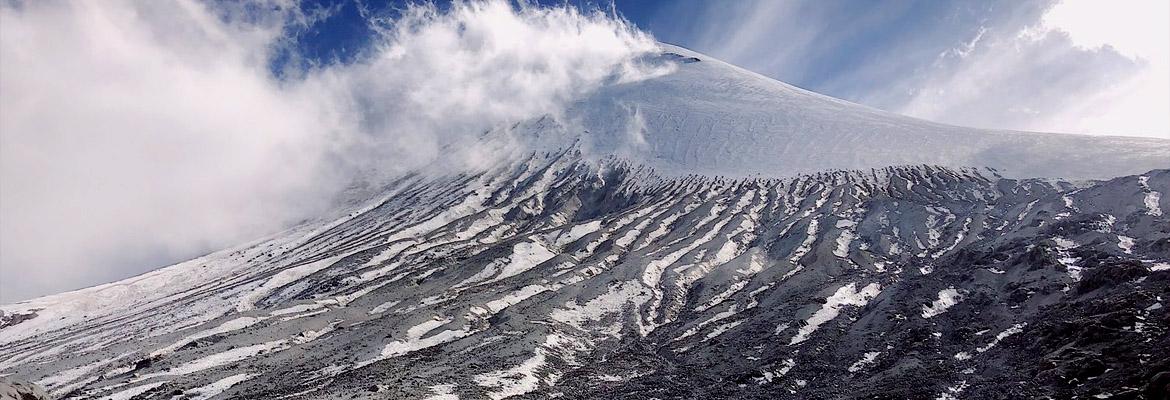
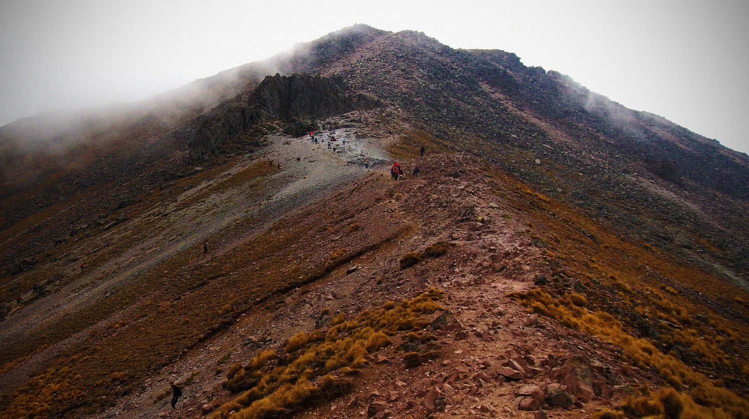
1| Pico de Orizaba
.jpg)
Situated just 300 kilometres (185 miles) east of Mexico City, Pico de Orizaba is the tallest mountain in the country and the third highest peak in North America.
The glaciated dormant strato-volcano towers over the eastern end of the Trans-Mexican Volcanic Belt and separates the country’s central plateau from the coastal plains that roll on to the Gulf of Mexico. Along with being the third highest summit on the continent, Orizaba also holds the distinction of being one of the world's Seven Volcanic Summits.
How to get there
For international travelers coming into Mexico, Pico de Orizaba is fairly easy to reach. Most guides will opt to meet in either Mexico City or Puebla, which can be reached by a domestic connecting flight from the main international airport.
From here, climbers will either transfer to Tlachichuca in order to climb the Jamapa Glacier route or drive to el Ciudad Serdan or Atzinzitla to take the Ruta del Sur.
Challenges of climbing Pico de Orizaba
Overall, climbing Pico de Orizaba is an intermediate-level mountaineering challenge.
The main Jamapa Glacier route only requires some intermediate glacier climbing and rope travel skills. The slightly tougher Ruta del Sur, however, does require some more advanced snow and ice climbing techniques toward the summit.
Regardless of which route is chosen to climb, the ascent does require a high-level of physical fitness.
Climbers will be carrying fairly heavy packs (15 to 20 kilograms/30 to 45 lbs) and ascending and descending for up to 15 hours on summit day, with minimal opportunities to stop and rest. As a result, most guides recommend participants to spend a couple of months improving endurance, leg, back and core strength prior to arriving in Mexico.
Routes to the summit
As previously mentioned, there are two main routes to the summit of Pico de Orizaba. The Jamapa Glacier route is the easier of the two and is therefore the most popular to climb.
Starting from the Piedra Grande mountain hut, at 4,270 metres (14,010 feet), climbers will hike straight up the northwestern side of the glacier until reaching the summit. The ascent is fairly straightforward and, as long as participants are physically fit enough, no previous glacier climbing experience is required.
On the other hand, the Ruta del Sur is a more technically challenging option that is perfect for more advanced climbers. The route is popularly used as a warm up by climbers heading to the Andes or the Alaska Range later in the season.
Starting from the Fausto Gonzales hut, this route avoids the glaciers of Pico de Orizaba and instead takes climbers straight up the mountain’s southern face and requires 10 pitches of grade 3 ice climbing to complete.
Quick facts:
- Elevation: 5,610 m (18,406 ft)
- Duration: 2 days
- Difficulty: Intermediate
- Climbing Season: November to May
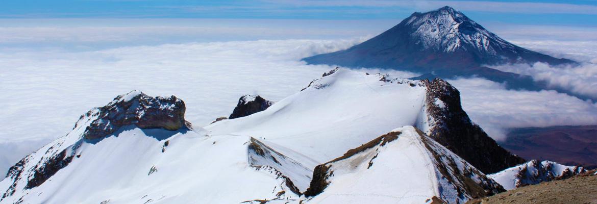
2| Iztaccihuatl
Also known as the “sleeping woman” due to its distinctive shape, Iztaccihuatl is the third highest peak in Mexico and eight tallest in North America.
The dormant volcano stands out from many of Mexico’s other popular mountaineering destinations for its distinctive shape. As its nickname may suggest, when viewed from the east or west, the mountain resembles the shape of a sleeping woman, with each of its summits representing a body part.
From north or south, these are la Cabellera (the hair), la Cabeza (the head), la Oreja (the ear), el Cuello (the neck), el Pecho (the breast), la Barriga or la Panza (the stomach or belly), las Rodillas (the knees) and los Pies (the feet).
How to get there
Iztaccihuatl sits just 70 kilometres (45 miles) southeast of Mexico City, at the eastern end of the Trans-Mexican Volcanic Belt. On a clear day, the peak can be seen from the center of the city.
Most guides will opt to meet climbers heading to Iztaccihuatl in Mexico City and provide transport to the start of the trip. The volcano only takes a couple of days to climb, so climbers will generally drive out with the guide on the first day and return in the evening of the second.
Challenges of climbing Iztaccihuatl
Iztaccihuatl is not considered to be a very technically difficult mountain to climb. The peak usually has some snow and ice at the top and boasts a few modest glaciers.
As a result, climbers will need to take on some glacier, snow and ice climbing. Most guides do not require previous experience with any of these as all the necessary skills can be taught prior to the ascent (this usually adds another day to the trip, though).
In spite of the low level of technical difficulty, climbing Iztaccihuatl does require a fairly high level of physical fitness. The majority of the climb takes place above 4,000 metres (13,100 feet) and participants should be prepared to traverse steep and uneven surfaces for up to five hours at a time with minimal stops.
Routes to the summit
While there are a few different routes routinely used by climbers to get to the top of Iztaccihuatl, la Arista del Sol is easily the most popular and commonly used.
Beginning from the La Joya trailhead at 3,975 metres (13,040 feet), climbers will begin their ascent at “the feet” and continue on to “the knees”, where the only hut on the mountain is located.
Getting an early start the following day, climbers will continue to ascend northward toward “the chest”, which is the highest of the summits on the peak and therefore the most popular destination.
Other routes up Iztaccihuatl begin from the north of the mountain and traverse “the head” and “the neck” before arriving at “the chest”.
Quick facts:
- Elevation: 5,230 m (17,160 ft
- Duration: 2 days
- Difficulty: Intermediate
- Climbing Season: October to March
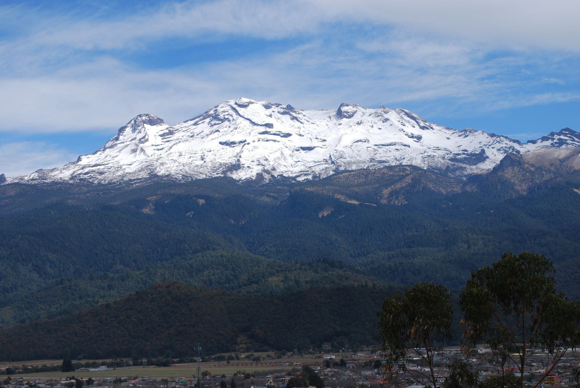
3| Nevado de Toluca
.jpg)
Situated roughly 100 kilometres (50 miles) southwest of Mexico City, Nevado de Toluca is a massive stratovolcano that has long held importance to the people of Mexico.
The volcanic massif is the fourth highest mountain in Mexico. In the middle of the summit is a massive caldera, which stretches for 1.5 kilometres (1 mile) in diameter. The central caldera is surrounded by a series of summits, the tallest of which is known as Pico del Fraile (Friar’s Peak).
The volcano sits within a national park and along with various hiking and climbing trails, is home to 18 different archaeological sites.
How to get there
Most guides will opt to meet climbers headed to Nevado de Toluca in Mexico City. Starting early in the morning, there is usually plenty of time to drive from the capital to the national park, climb the main peaks of the mountain and return to the city in the evening.
As a result of its close proximity to the city and easy access, many climbers heading to Pico de Orizaba or Iztaccihuatl opt to climb Nevado de Toluca first in order to warm up and acclimate.
Challenges of climbing Nevado de Toluca
Nevado de Toluca is a great destination for beginner mountaineers and first-time climbers. No technical ability is required to get to the top of either of the main summits – Pico del Fraile or Pico de Aiguille (Eagle Peak) – and the toughest routes up either require grade 3 to grade 5 scrambling.
However, most of the climbing takes place above 4,000 metres (13,100 feet), so a moderate level of physical fitness is required to manage the ascent.
Routes to the summit
The most commonly taken route to the top of Pico del Fraile is either the Northeast Slopes and North Ridge Route or the East Ridge. Neither of these require technical mountaineering abilities when there is no snow. However, if there is snow, crampons and ice axes are recommended for the climb.
The Northeast Slopes and North Ridge Route requires a fairly steep hike up the slopes of the northeast side of the peak before arriving at the ridge line. From here, a comfortable class 3 scramble is required to reach the top.
The East Ridge route is a bit more technical, requiring sections of class 3 and class 4 scrambling as the ridge is traversed from its base to the top. However, it is less steep than the other route.
Mountaineers looking for a slightly more challenging option may opt for the complete rim traverse. The route is considered to be the most alpine route in Mexico and is fairly simple to complete (Class I/II).
When dry, the route can be completed with just a rope and no other technical equipment. If it is covered in snow, the route requires crampons and ice axe.
Quick facts:
- Elevation: 4,680 m (15,350 ft)
- Duration: 1 day
- Difficulty: Advanced Beginner
- Climbing Season: November to May
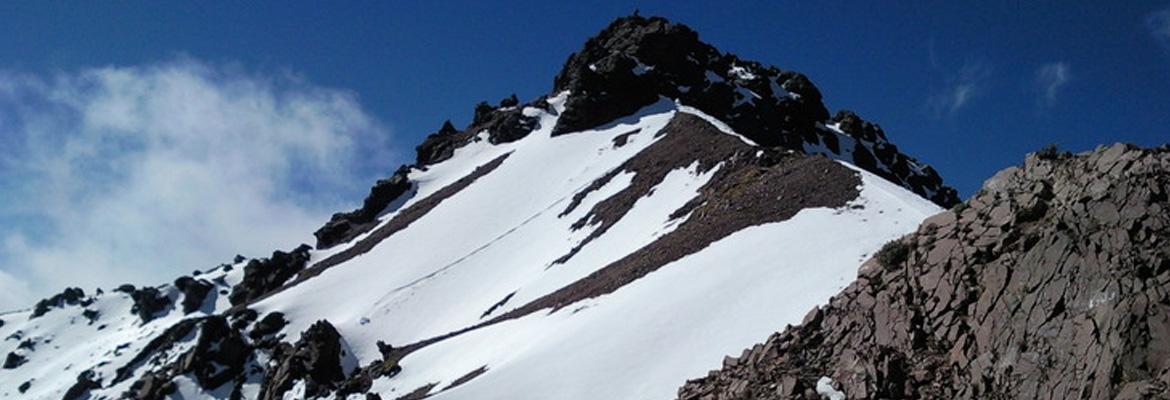
4| La Malinche
Situated on the eastern end of the Trans-Mexican Volcanic Belt, La Malinche is the sixth highest mountain in Mexico and a popular mountaineering destination.
Along with boasting some of the best views of the volcanic belt, La Malinche provides the perfect challenge for beginner mountaineers and more advanced climbers preparing for an ascent of Pico de Orizaba or Iztaccihuatl.
How to get there
Most trips to La Malinche begin with a flight into Mexico City International Airport (MEX) or Hermanos Serdán International Airport (PBC), in Puebla.
Most guides opt to meet either at the airport or in the city and provide transport to the start of the trip. However, it is also possible to take two or more buses from the airports to the trailhead.
La Malinche sits right in between Pico de Orizaba and Iztaccihuatl making it a convenient starting point for multi-peak ascents in the mountain range.
Challenges of climbing La Malinche
No technical climbing experience or gear is required to get to the summit of La Malinche. In fact, it is a popular destination for families and casual hikers as well as mountaineers.
Due to the elevation, some acclimatisation is required before heading up to the summit of the peak and a moderate level of physical fitness is also required to make the most of the climb.
Routes to the summit
Overall, there are four main routes that lead to the summit of La Malinche. The most popular of these is the Centro Vacacional Route.
From the trailhead, the climb begins with a quick ascent of a series of switchbacks. After a while, climbers will veer of onto another trail and climb up above the treeline. Once above the treeline, it is easiest to turn onto the main ridge line up and follow it up to the summit. Some modest scrambling is required toward the top.
The second most popular trail to the summit is the Altamira Route, which heads up to the top of the mountain from the northeast. From the trailhead, the ascent is quite straightforward. Trekking poles may be required if snow has fallen recently, but otherwise the path is quite walkable.
Three other routes to the top may also be used, though they are not climbed quite as frequently as the aforementioned two. These each climb up the peak from other sides of the mountain. While none of them are technically challenging, arriving at the trailheads is more difficult than for the two most commonly climbed routes.
Quick facts:
- Elevation: 4,461 m (14,636 ft)
- Duration: 1 day
- Difficulty: Beginner
- Climbing Season: November to May
5| Picacho del Diablo
.jpg)
Away from the Trans-Mexican Volcanic Belt, Mexico boasts plenty of incredible mountaineering options. For those seeking to get off the beaten path and enjoy a thoroughly challenging but stunningly scenic accent, Picacho del Diablo is the perfect option.
Located in the centre of the Baja California peninsula, at the heart of the Sierra de San Pedro Mártir, Picacho del Diablo is an exposed granite peak that combines wilderness navigation with traversing rugged desert terrain.
On a clear day, both the Pacific Ocean and Sea of Cortez can be seen from its summit. However, arriving here not only requires climbing up to 3,000 metres (9,800 feet) above sea level, but traversing the deep canyon and rugged terrain below.
How to get there
Most trips to Picacho del Diablo begin with a flight into General Abelardo L. Rodríguez International Airport (TIJ), in Tijuana. Most guides will opt to meet here and provide transport to the start of the trip, which is roughly four hours south of Tijuana by car.
Challenges of climbing Picacho del Diablo
While Picacho del Diablo is not a very technically difficult climb, making it to the summit of the highest peak on the Baja California peninsula comes with its fair share of challenges.
The first of these is dealing with how remote the mountain is. No towns or cities are located nearby the peak and inside the national park there are few amenities. Therefore, climbers will need to carry three day’s worth of gear and campaign equipment up and down the mountain.
Technically speaking, climbers will need to be able to handle class 3 scrambling at various points on the climb and also be prepared to spend hours hiking through rough terrain.
Trails are not well marked, so wilderness navigation is essential. (Also why hiring a guide is highly recommended). It is not rare for park rangers to mount rescue operations to find lost climbers.
Routes to the summit
The main route that leads to the summit of Picacho del Diablo is known as the standard west route. There is also a route that approaches from the north, but this route is taken less frequently and not recommended by local authorities.
The standard west route begins from Vallecitos Meadow trailhead and starts with a hiking approach through some fairly rugged terrain, before arriving at Bluebottle Saddle.
From here, climbers traverse Bluebottle Peak (some opt to climb it and enjoy the views of the surroundings) before descending into the Canyon del Diablo and arriving at Camp Noche.
The following morning, climbers will ascend the eastern slope of the canyon before descending into another gully. Afterwards, climbers will scramble out of the gully and onto the side of the peak.
Once out of the gully, climbers will be on a dihedral slab and be able to scramble up along this and continue on to the summit.
Quick facts:
- Elevation: 3,096 m (10,157 ft)
- Duration: 3 to 5 days
- Difficulty: Advanced
- Climbing Season: Year-round
Get out and enjoy somewhere new
.jpg)
The unprecedented health crisis presented by COVID-19 has forced us to rethink many aspects of our lives, including how we spend leisure time.
Heading on a late season mountaineering trip to Mexico is one way to take the many negatives presented by the pandemic and try to get a positive result out.