The Rongai Route is the only route that appraoches Kilimanjaro from the north, near the Kenyan border. Rongai’s ascent profile is very similar to that of Marangu. It is one of Kilimanjaro’s easier routes. The climb to the top is gradual and steady. However, unlike Marangu, this route has low crowds and passes through remote wilderness areas. It is probably the only route where seeing wildlife in the first days is possible.
Scenically, Rongai is beautiful because it travels through an unspoiled rain forest and remote wilderness area. However, it is not as scenically varied as Machame, Lemosho and Shira. Rongai is ideal for those who are not confident in their ability to hike over steeper paths, those who want to avoid traffic, and those who want to enjoy a quieter hike. It is also preferred when climbing during the rainy season because the north side of the mountain receives less precipitation.
Itinerary
Day 1: Rongai Gate (1,800m/5,900ft) to First Cave Camp (2,600m/8,400ft)(Elevation Gain: 760 meters, 2,000 feet)
After an early breakfast in Moshi, drive to the Rongai Gate near the Kenya border. After registering at the gate, begin your climb to Uhuru Peak, the roof of Africa. During the first day, hike through forests where you may see and hear wildlife. Eat lunch on the trail before continuing to the first campsite. Rongai ascends via the less forested northern side of the mountain. Rongai Route is one of the least crowded routes on Kilimanjaro because of the long drive to the gate. The Rongai trail is thought to have the best chance of viewing wildlife.
Day 2: First Cave Camp (2,600m/8,400ft) to Kikelewa Camp (3,600m/11,810ft) Elevation Gain: 1,000 meters, 3,280 feet.
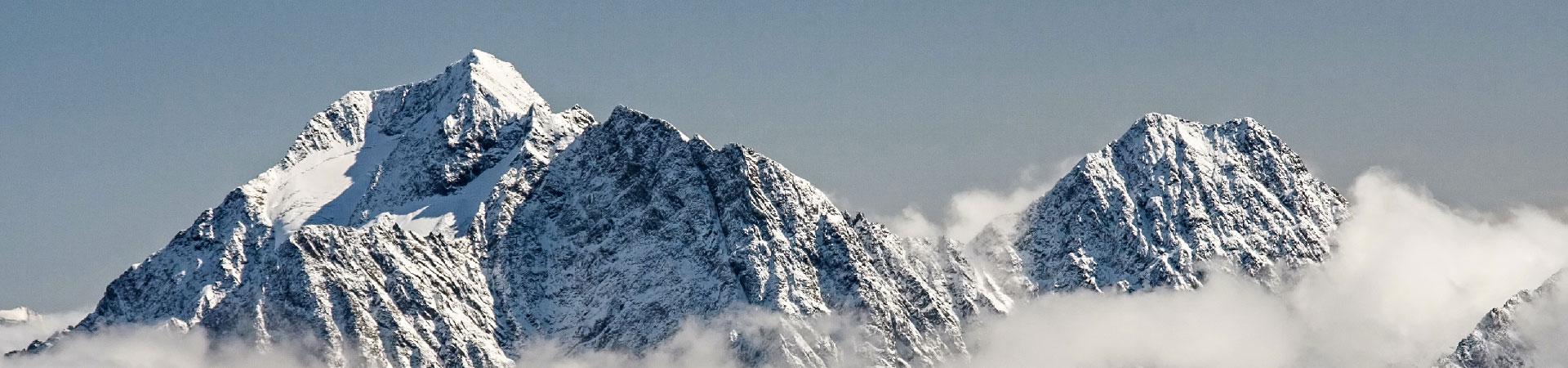
During day two hike through Kilimanjaro’s moorland. The Rongai route is relatively short and steep, making for shorter hiking times. During this day, view Mawenzi Peak ahead.
Day 3: Kikelewa Camp (3,600m/11,810ft) to Mawenzi Tarn Camp (4,330m/14,200ft) Elevation Gain: 730 meters, 2,390 feet
This day is an acclimatization day, allowing you to hike in the beginning of the day and rest in the afternoon and evening. The hike is relatively short but steep. The Mawenzi Tarn campsite is situated below Mawenzi Peak and offers stunning views of both Mawenzi and Kibo.
Day 4: Mawenzi Tarn Camp
Day four is an acclimatization day at Mawenzi Tarn. We advise hiking a bit higher this day before returning to Mawenzi Tarn in the afternoon.
Day 5: Mawenzi Tarn Camp (4,330m/14,200ft) to Kibo Camp (4,750m/15,580ft) Elevation Gain: 420 meters/1380 feet
Cross the lunar landscape of the saddle on this day to arrive at the final campsite. Kibo Camp is situated directly below the Kibo cone, giving you views of your final destination.
Day 6: Kibo Camp (4,750m/15,580ft) to Uhuru Peak (5,895m/19,340ft) to Horombo Hut (3,720m/12,200ft) – Elevation Gain: 1,145 meters, 3,760 feet, Elevation Loss: 2,175 meters, 7,140 feet
Around midnight, begin the final ascent to Uhuru Peak, the highest point in Africa. For the next six hours, hike by the light of your flashlight. The ascent to the crater rim is the most challenging part of the entire trek. The trail is very steep until you reach the crater rim at Gilman’s Point. The hike from Gilman’s to Uhuru Peak is a gradual climb and, as far as hikes go, not very difficult. The altitude, however, makes the hike long and tiring. The crater rim hike takes approximately two hours. Upon reaching Uhuru, take photos of your guide and group at the peak before beginning the descent to Horombo Hut.
Day 7: Horombo Hut (3,720m/12,200ft) to Marangu Gate (1,800m/5,905ft) – Elevation Loss: 1,920 meters, 6,295 feet
After breakfast, finish the trek with a descent to Marangu Gate. Your last hike on Kilimanjaro is a beautiful one, passing through Kilimanjaro’s cloud forest. Watch your step during the descent, as the trail can be slippery. Our vehicles will be waiting at Marangu Gate to take you back to Moshi/Moshi. You will be able to buy t-shirts and sodas at the gate.
