Top 5 Climbing Destinations in East Africa
Home to a diverse array of landscapes and some of the most iconic animals on the planet, East Africa has become an increasingly popular tourist destination over the previous four decades.
While millions of tourists head to the savannas and tropical rainforests of Tanzania, Kenya and Uganda each year to go on game drives and see some of the continent's most famed animal species, tens of thousands of others opt to head to the mountains.
Running from the Democratic Republic of the Congo down through Tanzania, the Eastern Rift Mountains is Africa's premier trekking destination and home to the continent's highest peaks.
The mountain ranges were formed due to three tectonic plates slowly moving away from one another, which created the rift valley. The various peaks in the mountain range either make up the eastern border of the valley (hence the name) or were formed as the result of volcanic activity within the valley.
While the most popular destination in the Eastern Rift Mountains is easily Mount Kilimanjaro, which is the highest mountain in Africa and the most climbed, there are plenty of other great destinations for climbers of every level.
Below are five top trekking destinations, with most visitors to the region opting to climb at least two during their trip. Along with the climbing, many guides also offer safaris at the end of an expedition, adding to the allure of exploring this unique and diverse part of the world.
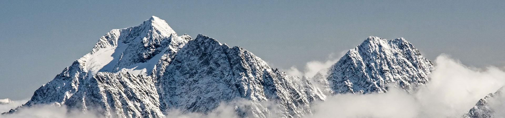
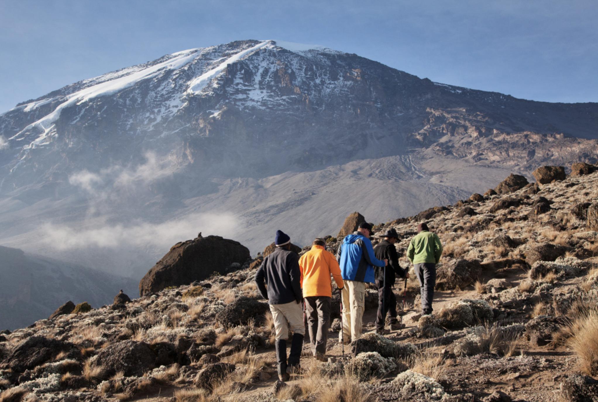
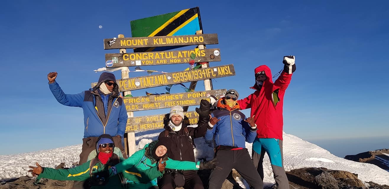
1| Mount Kilimanjaro

Towering nearly 6,000 metres (19,700 feet) above the surrounding rainforests and savanna, Mount Kilimanjaro is the tallest mountain in Africa and the fourth most prominent mountain on Earth.
Known as Uruhu to the locals, which means "freedom" in Swahili, Kilimanjaro is composed of three volcanic cones – Kibo, Mawenzi and Shira – and rises high above the rest of the Eastern Rift Mountains near Tanzania's border with Kenya.
The dormant stratovolcano is widely considered to be the easiest of the world's Seven Summits to climb (on the Messner List), requiring no technical abilities on the easiest routes. As a result, it is the most frequently climbed peak in Africa, with roughly 30,000 hikers and climbers heading to its summit each year.
Despite its moniker as the easiest of the Seven Summits, Kilimanjaro boasts plenty of challenges, with the chief among them being the altitude. With an elevation differential of 5,885 metres (19,308 feet) from base to summit, acclimatisation is key. The vast majority of the roughly 10,500 people who do not make it to the top each year fail to do so because of altitude sickness.
Keep reading: Climbing Elbrus and Kilimanjaro: How the First 2 of the Seven Summits Compare
Being in excellent physical condition before heading out on the climb helps ensure a fun and successful ascent, which culminates with a sublime sunrise over the eastern savannah. Being in shape, especially in terms of cardiovascular strength, also helps with acclimatisation.
Picking an appropriate route further helps ensure success. Overall, six major routes lead to the summit of Kilimanjaro: Lemosho, Machame, Marangu, the Northern Circuit, Rongai and Umbwe.
Of these, the Marangu route is the shortest and one of the easiest, making it the most commonly used. However, the route is quite steep and does not allow for the same acclimatisation as the other routes do.
The Machame route is considered the easiest, though it takes a longer trail to the summit and is a bit more expensive than the Marangu route.
Regardless of the route taken, the most challenging part of the climb comes on summit day. Making a pre-dawn start – irrespective of the route – climbers will make a long and steep ascent alongside the mountain's summit glacier to get to the top by mid-morning.
Quick facts:
- Location: Tanzania
- Elevation: 5,895 m (19,341 ft)
- Duration: 1 week
- Best period: June to October, January to March
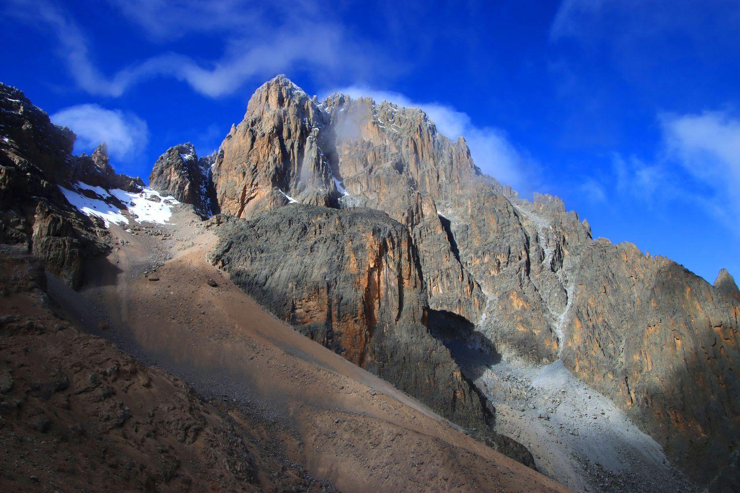
2| Mount Kenya
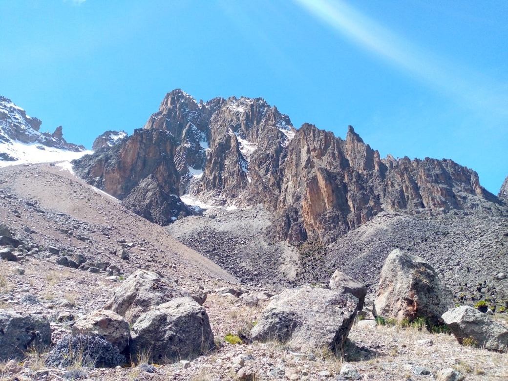
Africa's second-highest peak towers above its neighbours in the Eastern Rift Mountains and offers various climbing options for mountaineers of all levels.
Located just 150 kilometres (90 miles) north-northwest of the country's capital, Nairobi, Mount Kenya is a dormant stratovolcano composed of three separate summits – Batian (5,199 m/17,057 ft), Nelion (5,188 m/17,021 ft) and Point Lenana (4,985 m/16,355 ft).
The toughest of these, Batian, requires highly technical rock climbing abilities to climb successfully and is eagerly sought out by upper-intermediate rock climbers and mountaineers to test their abilities in the unique environment that the mountain creates.
The easiest of the summits to reach is Point Lenana, which can be attained by intermediate-level trekkers and requires no technical mountaineering abilities to reach.
However, many climbers opt to head up all three summits on a single expedition, which provides the perfect opportunity to explore the various microclimates in the valleys radiating out from the peak and see some of the mountain range's unique and endemic wildlife.
As was just foreshadowed, Mount Kenya offers several different challenges for mountaineers seeking to reach its summit.
Many adventurers who want to spend more time exploring the valleys in the national park surrounding Mount Kenya opt to head to Point Lenana. While a high level of physical fitness is still required to reach the minor summit, only basic scrambling is needed on the climb.
However, most climbers opt to head to Nelion and Batian, both of which require more advanced climbing abilities. Climbing Nelion involves a multi-pitch ascent of the various igneous rocks that make up the mountain, ranging in difficulty up to Class IV-.
Continuing to Batian requires even more and steeper multi-pitch climbing with difficulties ranging from Class IV to IV+. The route most climbers take to this summit is based mainly on the time of year that the peak is climbed.
Overall, five main routes are routinely used to climb to Point Lenana, and an additional five routes are used to climb Nelion and Batian.
Due to the immense diversity of the area, most climbers opt to take one route up to Point Lenana and another one down. The most popular of these routes is the Naro Moru, which is the shortest and climbs up to the minor summit from the west, and the Sirimon, which climbs the peak from the north.
For climbers continuing to Nelion and Batian, the most popular options are the south ridge route and north face route, respectively. The south ridge route is one of the most scenic that leads up to the second-highest summit on the mountain and is plenty challenging with 18 pitches of Class IV- climbing.
For those who are heading straight to Batian, the aforementioned north face route is the most popular. The challenging climb is also quite scenic and involves a 12-hour multi-pitch ascent. Many climbers opt to break the climb into two days and sleep on a narrow shelf on the massive rock face.
Away from these routes, two great combined routes allow climbers to reach both Nelion and Batian: the Ice Window route (Class V-) and the Diamond Couloir (Class VI).
Quick facts:
- Location: Kenya
- Elevation: 5,199 m (17,057 ft)
- Duration: 1 week
- Best period: December to March, July to September
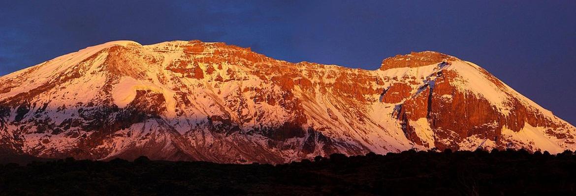
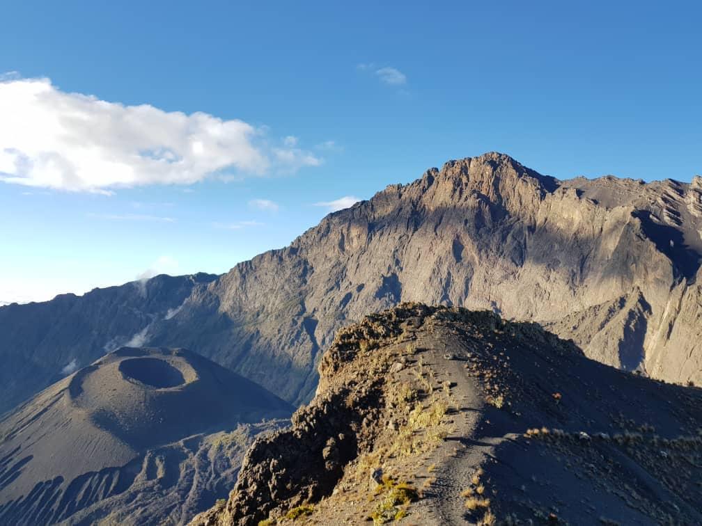
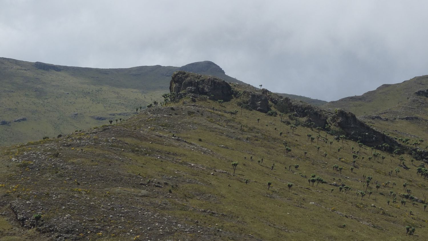
3| Mount Meru
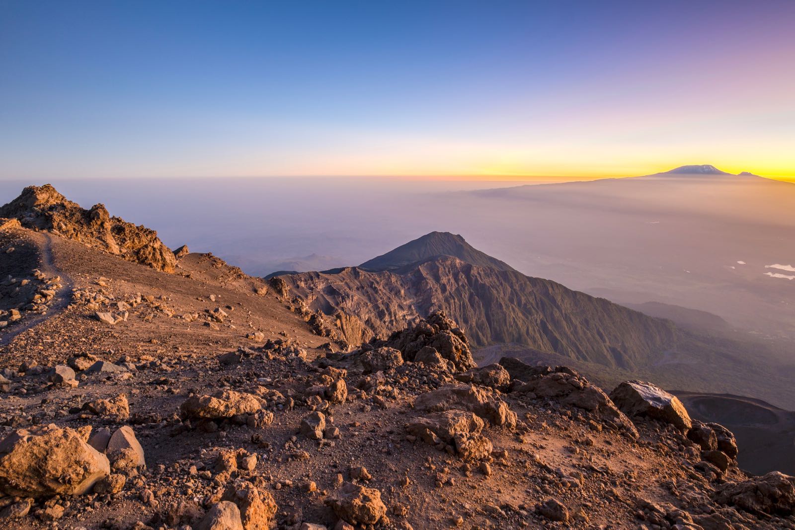
Rising high over the savannah of northeastern Tanzania and located just 70 kilometres (45 miles) west of Kilimanjaro, Mount Meru is the second-highest peak in Tanzania and the fifth-tallest in Africa.
Situated in the heart of the stunningly scenic and immensely biodiverse Arusha National Park, Mount Meru is considered a trekking peak and is frequently used as a warmup by climbers with the summit of Kilimanjaro in their sights.
Like the vast majority of the other mountains surrounding the Great Rift Valley, Mount Meru is a dormant volcanic peak. More than 500,000 years ago, the peak experienced a major eruption, which created its unique shape. The summit sits on the western rim of the volcano and boasts a 1,500-metre (4,900-foot) deep crater.
While only some simple scrambling is required to reach the summit of Mount Meru, climbing the peak does require a relatively high level of physical fitness. With a change in elevation of 3,170 m (10,400 ft) from top to bottom, the peak also serves as the perfect acclimatisation climb for Kilimanjaro.
Due to the unique shape of the volcano, there is only one major trail that leads to the summit: the Momella route. Starting from Momella gate, just east of the mountain, the ascent begins with a scenic hike through the savannah and some tropical rainforests before arriving at the end of the valley.
From here, climbers ascend through more forest until arriving at Miriakamba Hut. The following day, climbers continue hiking through increasingly steep forests and bush before giving way to the volcanic terrain toward the summit.
After passing by the minor summit of Little Meru (3,800 m/ 12,500 ft) and Rhino Point, climbers face one last scrambling ascent to the top of the western rim and the summit. From the top, there are incredible views, including some of Kilimanjaro, which serves as an ample reward for the effort to get there.
Quick facts:
- Location: Tanzania
- Elevation: 4,562 m (14,967 ft)
- Duration: 2 to 3 days
- Best period: June to October, January to March
4| Ol Doinyo Lengai
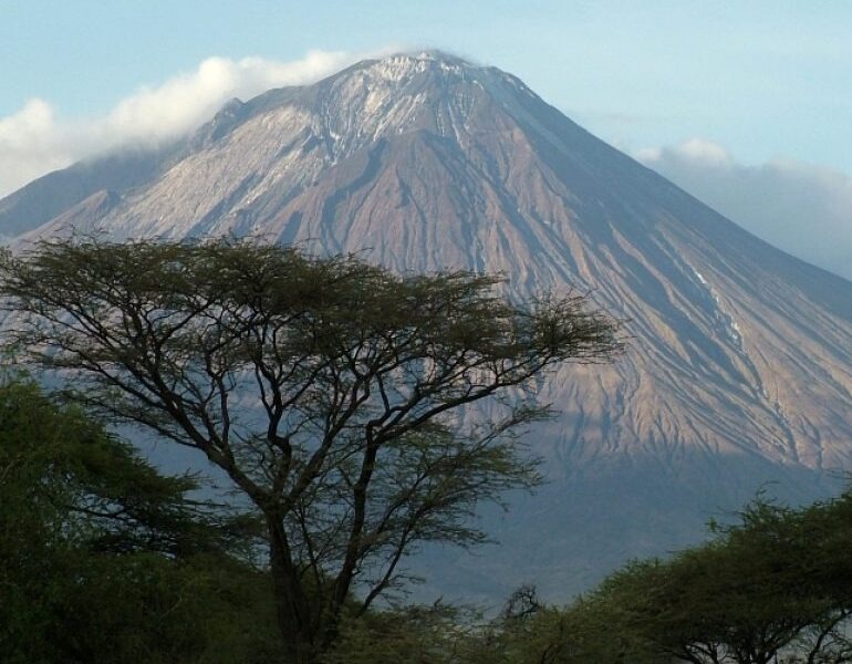
Situated roughly 165 kilometres (100 miles) west of Kilimanjaro, in the heart of the Rift Valley, Ol Doinyo Lengai towers prominently above the surrounding savanna.
Translating to "Mountain of God" in the native Maasai language, the active volcano is far from Tanzania's most popular trekking destination but still a common offering among dedicated trekking guides.
This lack of foot traffic compared to nearby Kilimanjaro and Mount Meru is precisely what makes the peak popular with trekkers looking to get off the beaten path and enjoy the unspoiled scenery of the Rift Valley.
Ol Doinyo Lengai's summit boasts stunning views of the barren salt flats of Lake Natron to the north, Kilimanjaro to the east, the crater highlands to the south and the forested escarpment of the Rift Valley to the west.
The main route up to the summit ridge of the volcano begins from the northwest. While no technical mountaineering ability is required, the ascent is very steep, with slopes up to 45 degrees.
Many guides opt to spend a night camping near the volcano to enjoy the stunning night skies. Due to the remote nature of the mountain and the difficulty required to get there, many guides combine an expedition to the volcano with a safari.
Quick facts:
- Location: Tanzania
- Elevation: 3,188 m (10,459 ft)
- Duration: 2 to 3 days
- Best period: January to February, June to September
5| Ol Doinyo Lesatima
Situated about 80 kilometres (50 miles) west-southwest of the massive Mount Kenya is Ol Doinyo Lesatima. Rising to just over 4,000 metres in elevation, Oldoinyo Lesatima is the third-highest mountain in Kenya and the tallest of the Aberdare Range.
Ol Doinyo Lesatima is located at the very northern end of this small Eastern Rift Mountains subrange, which serves as part of the western border of the Great Rift Valley. The summit of the mountain boasts excellent views out over the valley as well as of Mount Kenya.
In the local Maasai language, Ol Doinyo Lesatima translates to "mountain of the bull calf," and the name serves aptly. One of the main draws of hiking the mountain is to see the wildlife that lives in the area, including elephants.
Unlike neighbouring Mount Kenya, Ol Doinyo Lesatima – also known as Mount Satima – is far less popular. For those in the know, it serves as the perfect acclimatisation hike for climbers aspiring to reach the summit of Africa's Second Summit.
Despite its fairly high elevation, Ol Doinyo Lesatima is a trekking peak and requires no technical difficulty to climb. However, parts of the hike are a bit steeper than others, and a good level of physical fitness is required.
The main route up to the summit of Ol Doinyo Lesatima begins from the eastern side of the mountain and ascends via the southeast ridge. Hikers start by following a muddy road until arriving at the start of the ridgeline before following it up to the false summit.
From here, hikers will turn off of the main trail and head south, briefly descending, before climbing up to the true summit, which is only a bit higher than the false summit. After taking in the views, hikers retrace their steps down to the road.
Quick facts:
- Location: Kenya
- Elevation: 4,001 m (13,127 ft)
- Duration: 1 day
- Best period: December to March, July to September
BONUS| Mount Elgon
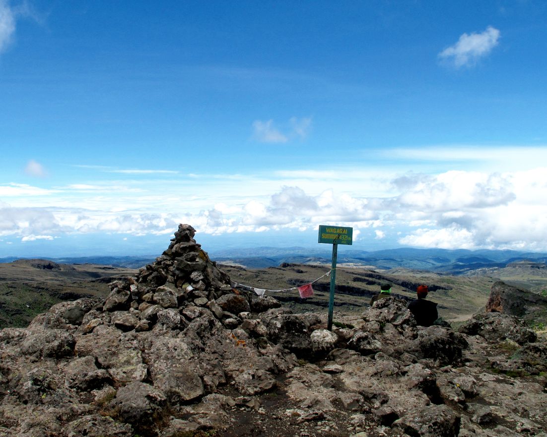
Mount Elgon is an extinct volcanic shield that towers more than 4,000 metres (13,100 feet) over the Ugandan-Kenyan border. However, the mountain's highest point, known as Wagagai, is located wholly in Uganda.
For many climbers familiar with the region, climbing Elgon is preferable to Kilimanjaro. Just like Africa's highest peak, Elgon boasts plenty of incredible scenery, but due to its more remote location and lower elevation, it is climbed far less frequently.
Among the many attractions for climbers and trekkers (the peak requires no technical difficulty to summit) are the volcano's caldera, which is the largest intact one in the world, the hot springs of the Suam River and the various caves found along the peak’s slopes.
While it is possible to climb the mountain from both the Ugandan (western) and Kenyan (eastern) sides of the border, many prefer to head to the peak from Uganda. The ascents from this side of the peak tend to be longer but are also more scenic.
Overall, the ascent of Mount Elgon takes between three and six days, depending on the route taken and whether or not climbers decide to visit the aforementioned geological features along with the volcano.
No technical mountaineering skills are needed to reach the summit. However, climbers should be in good physical condition and prepared for some beginner-level scrambling.
Seven different routes lead to the summit of Mount Elgon; four start from the Ugandan side of the border, including the most popular one, and three begin from the Kenyan side.
Of these, the most popular is the Sasa River route. Starting from the town of Budadiri, just west of the mountain, climbers will begin with a scenic approach through a tropical rainforest before ascending more steeply up through terraced fields on the flank of the volcano.
After arriving at the Mude Cave camp at 3,400 metres (11,155 feet), climbers will soon pass the timberline and have the option to head straight up to the summit or detour to climb one of the minor peaks first before heading to the main summit.
Another popular trail is the Pisawa Route, which climbs the volcano from the north. The route is a bit longer than the Sasa River route but is no less scenic and a bit less steep. Other routes on the Ugandan side include Sipi Route and the Suam trail.
Quick facts:
- Location: Uganda and Kenya
- Elevation: 4,321 m (14,177 ft)
- Duration: 1 week
- Best period: mid-December to March, June to July
Book your next East African mountaineering trip now!
With one of East Africa'speak's dry seasons rapidly approaching, there has never been a better time to get out and explore the incredible region. Start comparing trips and planning your next African mountaineering adventure with ExpedReview!